Ice age, Lake Agassiz impacted OT County
News | Published on April 10, 2023 at 3:48pm GMT+0000 | Author: Tucker Henderson
0Lake was at one time more than four times the size of Lake Superior
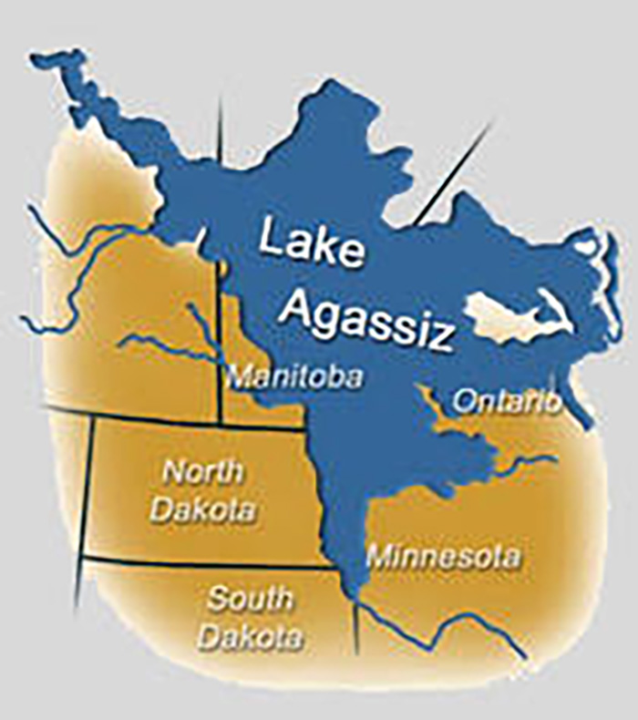
Lake Agassiz was more than four times the size of Lake Superior.
By Tom Hintgen
Otter Tail County Correspondent
This is the second in a series of articles about how the Ice Age and Lake Agassiz impacted Otter Tail County and other areas of west central Minnesota.
Many people driving along Highway 210 just west of the Fergus Falls municipal airport, as noted in our first story, visualize what was once the shoreline of the massive Lake Agassiz.
This huge lake, 12,000 years ago, was more than four times the size of Lake Superior. Eventually, at the end of the Ice Age, a channel to the north drained Lake Agassiz into Hudson Bay.
“This left lakes Winnipeg, Manitoba and Lake of the Woods as remnants,” says local historian Jim Welander, a Fergus Falls jeweler of 53 years.
He studied Lake Agassiz, earning Bachelor and Master’s degree credits in Geology at the University of North Dakota.
“The Ice Age lasted thousands of years,” said Welander, “and Otter Tail County had three major glaciations.”
Welander pointed out a rich local Native American history that includes harvesting Lake Agassiz fish spawning in what later became the Otter Tail River.
“This must have been an annual spring event for hundreds of years right at our waterfalls in downtown Fergus Falls,” Welander says.
Unfortunately, Indians had no written language. However, a fine place to view the spring spawning fish migration, mid-April, is the Pomme De Terre River spillway at Tipsinah Mounds Park east of Elbow Lake.
Minnesota has the oldest rocks on Earth, namely Ely greenstone and Morton granite which are 2.7 billion and 3.8 billion years old.
“Otter Tail County’s billion-year-old bedrock is an igneous rock called Diorite, similar to St. Cloud granite,” Welander says. “Both are fine building stone. Diorite’s composition is white colored plagioclase feldspar with black specs of iron and magnesium minerals.”
Adds Welander, “This bed rock is covered with 300-400 feet of glacial till, from glaciers ending 12,000 years ago. This makes Otter Tail County a most unique area.”
Glacial activity in Otter Tail County is seen in many area lakes, and in smoothed glacial till gravel. North of Otter Tail County, glacial gravel thins to exposed bed rock. The same is true traveling east and south.
“We are gifted with an unlimited supply of smooth gravel, pleasant to the touch,” Welander says. “Other areas of the United States use crushed rock for fill, flower beds and landscaping, which is sharp and rough.”
In 1995-96 a Canadian mining company, Cominco, explored our area by aerial magnetic mapping of the bedrock. A tool was used to identify ancient volcanos with potential diamond deposits, under the cover of glacial till.
A site was identified in Champion Township, Wilkin County, 18 miles west of Western Township, Otter Tail County.
“Core drilling was done to explore what lay below some 300 feet of till,” Welander said. “What was discovered is proprietary data of Cominco. They have a mineral claim in Wilkin County, which may or may not be worth pursuing.”
Other volcanic deposits may exist in Otter Tail County bedrock.